The official Gibraltar tourist map, free.
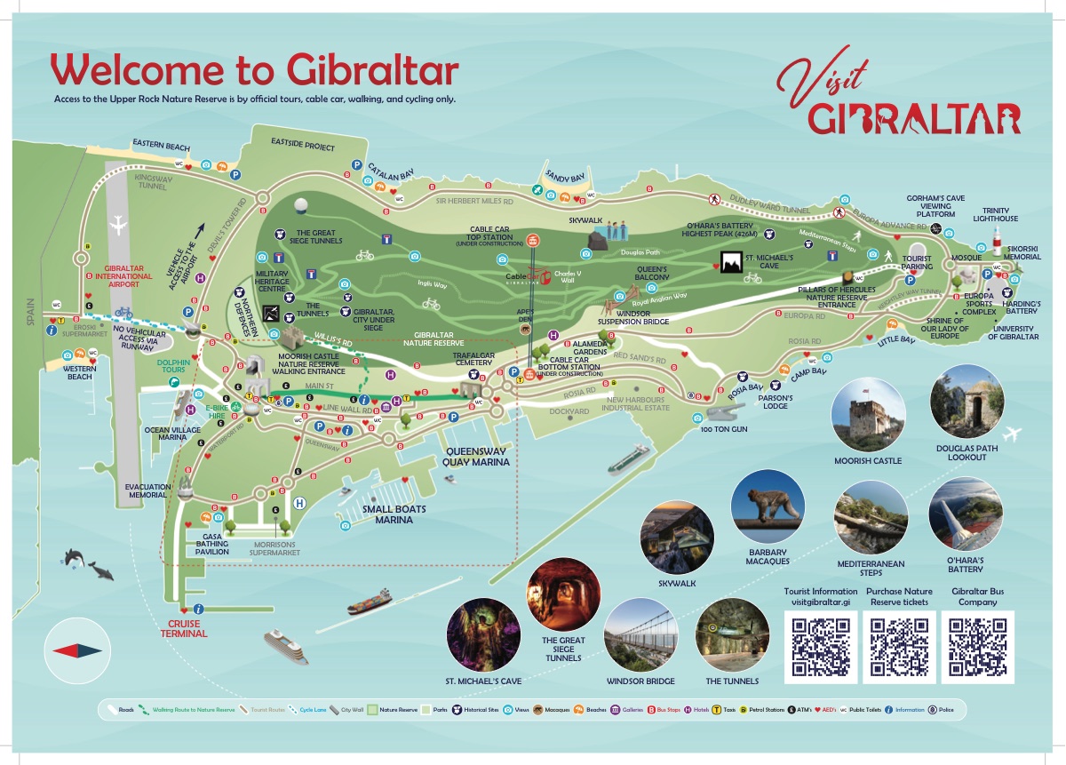
Not a redrawn approximation — this is the Gibraltar Tourist Board's own 2026 visitor map, the one handed out at the frontier and the cruise terminal. Print it before you come, or keep it on your phone for when the signal goes on the Upper Rock.
- Official Tourist Board edition
- 2026, current
- Print quality
- No email required
Download the official map
Two pages, print quality, straight from the Tourist Board's own artwork. Prints legibly on A4 and holds up on A3 if you have it.
Download the PDF · 5.4 MBFree, and free of us — no email, no sign-up, nothing to accept. We make nothing from this page.
Why it is the one to use
It is the Gibraltar Tourist Board's own map — the official 2026 edition, drawn by the people who run the place rather than traced off a satellite image by a travel site. Bus stops, car parks and toilets are where they actually are.
We did not make it and we take no credit for it. Copyright rests with the Tourist Board — visitgibraltar.gi.
What the official map marks
- Every bus stop, taxi rank and car park
- Public toilets, ATMs and defibrillators
- The Upper Rock Nature Reserve, with its walking entrance marked
- Cable car top and bottom stations
- Beaches on both coasts, and the cruise terminal
- Walking routes, cycle lanes and the line of the City Walls
One thing to know before you go
The map marks both cable car stations as under construction, which is correct — the cable car is shut and not due back until 2027. Anyone planning the ascent on the strength of the map alone will get a surprise at the bottom station.
What to do instead →Once you have the map
It shows you where things are. It will not tell you which of them are worth your morning, or which hotel on it is the one to book.